
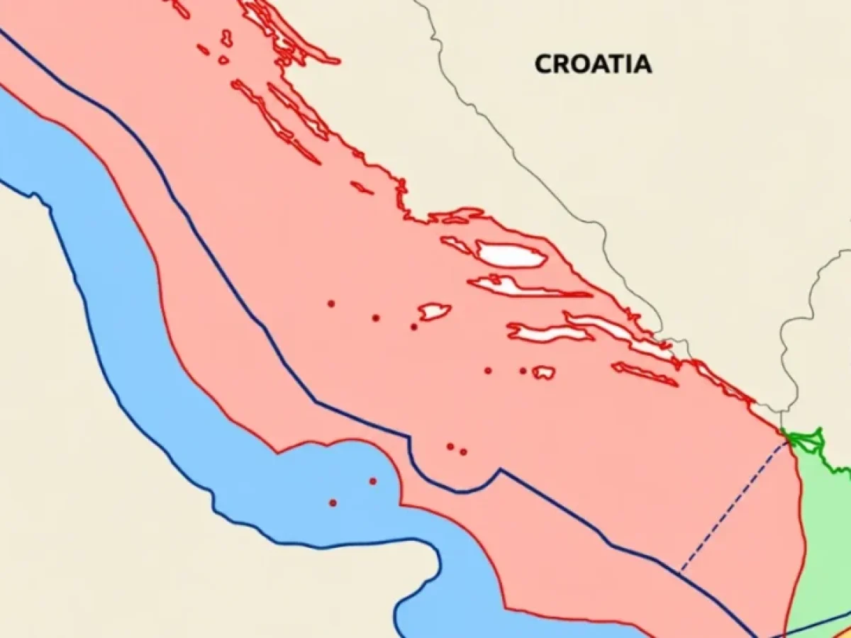
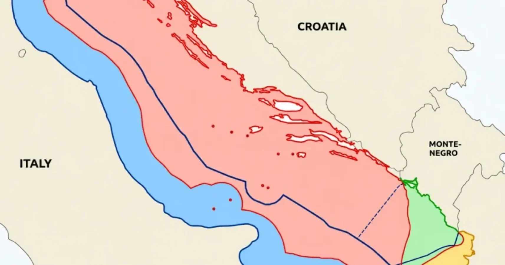
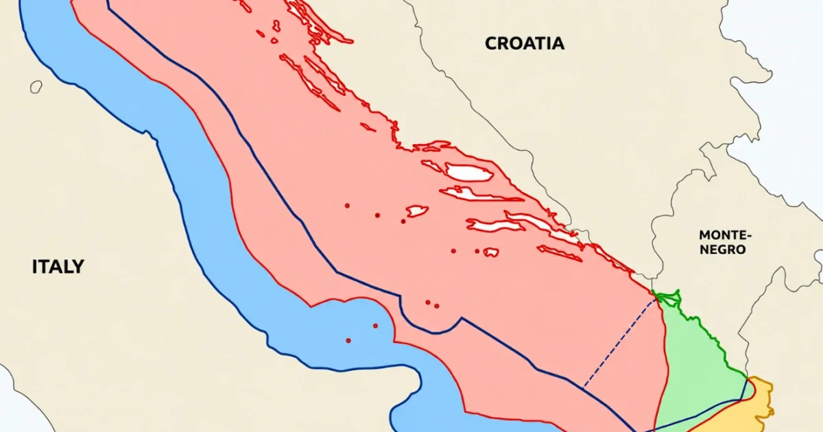
What happens if you apply Turkey’s maritime doctrine… to the Adriatic? 🗺️ For the Aegean and the Eastern Mediterranean, Ankara makes two claims: 1️⃣ Islands are not entitled to an EEZ or continental shelf beyond their territorial sea. 2️⃣ Maritime zones should be allocated “proportionally” to the length of mainland coasts. These are presented as general principles of “equity”. If they truly are general, they should work elsewhere. So we tested them in the Adriatic, where delimitation has already been settled and we can compare the results with reality. 📌 The reality Italy and Croatia signed an EEZ delimitation agreement in 2022, in force since 2024. It confirmed the 1968 Italy–Yugoslavia continental shelf line. Since January 2026 there are no high seas left in the Adriatic. The logic of the line is simple: ✅ Inhabited coastal islands (Krk, Cres, Brač, Hvar, Korčula, Vis, Lastovo) received full effect. ✅ Only uninhabited mid-sea islets (Palagruža, Jabuka) were limited, and reciprocally: Italy accepted the same discount for its own island of Pianosa. Italy, which would have gained from Turkey’s logic, never even proposed it. 📌 TestΤο άρθρο μπορεί να περιέχει συνδέσμους συνεργατών. 1: “Islands get only territorial waters” If Croatia’s islands received only 12 nm, Croatia would lose about 9% of its maritime zones (about 12% with 6 nm). Why “only” that much? Because in the Adriatic the islands sit close to Croatia’s own coast. In the Aegean, the Greek islands sit close to the Turkish coast, and the same rule strips Greece of most of its maritime zones. 👉 A rule that pays off more the closer your neighbour’s islands lie to your shore is not a principle of law. It is an outcome looking for a justification. 📌 Test 2: “Proportionality” based on coastal length This is where the problem becomes obvious. We calculated Croatia’s change in three ways: 🔹 Mainland coastal fronts (straight lines): −23% 🔹 Actual mainland coastline: −9% 🔹 Coastline including islands: +45% The same “principle” gives Croatia anything from −23% to +45%, depending solely on what you choose to measure. Using mainland coasts, Albania gains +52% simply because its coast is straight. Count the islands, and Italy loses a third of its zones. A method that produces such contradictory results is not a method. It is a tool: you pick the measurement that delivers the outcome you want. That is exactly why Turkey chooses, for the Aegean, the version that erases the islands. 📌 What international law says ⚖️ The International Court of Justice uses proportionality only as a final check on a result (Black Sea, 2009), not as a method for dividing the sea. ⚖️ That check counts all relevant coasts, including those of islands. ⚖️ Reduced effect for small islands lying off a foreign coast does exist in state practice (e.g., Italy–Tunisia, 1971). But it concerns islets, not islands like Rhodes, Lesbos, Chios or Crete. Their Adriatic equivalents, Brač, Hvar and Korčula, received full effect without any dispute. 📌 Conclusion The Adriatic is a natural laboratory: same law, same kind of sea, neighbouring states with islands. There, states agreed on a median line giving coastal islands full effect, with adjustments only for rocks in mid-sea. Applied anywhere else, the Turkish position either changes nothing of substance or produces absurd and self-contradictory results. It is not a universal principle. It is an argument tailored for one sea.
— Mpampis (@Mpampis71074595) October 23, 2026